


Creating Better Cities with the Help of Digital Visualization
Learn how digital visualization tools help design smarter, greener, and more livable cities for the future.

In todays fast-changing world, cities are growing faster than ever. As more people move to urban areas, we face new challenges. We need to build cities that are not only bigger but also smarter, safer, greener, and easier to live in. To solve these challenges, city planners, architects, and developers are turning to a powerful tool digital visualization.
This article explains how digital visualization is helping us create better cities. Well cover what it is, why it matters, and how it's being used today to design more livable and sustainable urban spaces.
What Is Digital Visualization?
Digital visualization is the use of computer-based tools to create images, animations, and simulations that represent real-world designs. In city planning, it means using 3D models, virtual reality (VR), augmented reality (AR), and other digital tools to show how a city or a specific area will look and function before it's built.
Instead of reading a flat map or technical blueprint, people can now see and explore a lifelike version of a new city street, park, or building. This helps planners and citizens understand the design better and make smarter decisions.
Why Cities Need Better Planning Tools
Planning a city is complex. You need to think about roads, buildings, parks, public transport, sunlight, air flow, traffic, and more. If any part is planned poorly, it can cause problems for years. Thats why it's important to get things right from the beginning.
In the past, many plans were made using 2D drawings and spreadsheets. But now, with digital visualization, planners can create realistic 3D models that are much easier to understand. These models help catch mistakes early and improve the final results.
Benefits of Digital Visualization in Urban Planning
1. Easier for Everyone to Understand
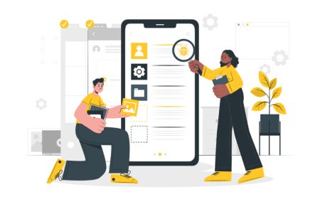
One of the biggest benefits of digital visualization is that it makes city planning easier for everyone to understand not just architects and engineers. Using 3D images and virtual tours, people can see exactly whats being planned.
This helps during public meetings and community feedback sessions. Citizens can give better feedback when they truly understand the proposed changes.
2. Better Teamwork Between Experts
Urban development projects often involve many people architects, planners, engineers, developers, and government officials. When everyone can see the same clear visual models, it becomes easier to work together.
Digital tools allow updates in real time. So, if something changes in the design, the whole team can see the new version right away and adjust their work.
3. Fewer Mistakes and Less Waste
Mistakes in city planning can be very costly. They can lead to buildings that dont fit, traffic problems, or unhappy communities. With digital visualization, planners can test different designs and spot problems early.
This helps avoid expensive changes during construction and reduces waste. It also saves time and money.
4. Testing Ideas Before Building
With tools like simulation and virtual reality, planners can test how different ideas will work. For example, they can simulate how traffic will flow, where the shadows will fall, or how people will move through a space.
This kind of testing helps make sure the city will work well in real life not just on paper.
Using Digital Twins to Manage Cities
A digital twin is a virtual copy of a real-world city or area. It uses real-time data from sensors, cameras, and systems to show what's happening in the city. For example, it can track energy use, traffic flow, air quality, and more.
Some cities, like Singapore and Helsinki, are already using digital twins to manage their services better. This helps make smarter decisions about roads, public transport, waste collection, and emergency services.
Digital twins are part of the future of smart cities, helping city leaders keep everything running smoothly.
How 3D Rendering Helps Urban Designers
3D rendering is a key part of digital visualization. It creates realistic images of buildings, parks, and streets before theyre built. This helps in many ways:
-
Visual storytelling: Investors and city officials can better imagine how a project will look.
-
Design review: Experts can study lighting, space, and materials more clearly.
-
Public engagement: People can take virtual tours of a neighborhood or street and understand how it will change.
If you want to see examples of this in action, check out how an urban plan render shows a proposed design for a public space in a highly realistic and engaging way.
VR and AR Make Design More Immersive

Virtual reality (VR) and augmented reality (AR) are also changing the way cities are planned. With VR, people can walk through a city project using a headset, even if it's not built yet. This is helpful for reviewing designs or getting community feedback.
AR allows users to place digital objects over real-world views using a tablet or phone. For example, a city planner can go to an empty lot and use AR to see how a new building would look there.
These technologies make urban design more interactive, visual, and fun.
Challenges of Digital Visualization
While digital tools are powerful, they also come with challenges:
-
Cost: Some tools and software are expensive.
-
Training: City staff and community members may need training to use them well.
-
Data accuracy: Visual models are only as good as the data behind them.
-
Privacy: Digital twins and real-time data raise concerns about surveillance and privacy.
Despite these challenges, many cities find the benefits outweigh the costs especially in large, complex projects.
Whats Next: AI and Smarter City Design
Artificial intelligence (AI) is now being added to digital visualization tools. AI can analyze big data to suggest better designs, predict traffic problems, or improve energy efficiency.
Imagine a system that recommends better road layouts, safer sidewalks, or greener buildings all based on real data. This is the future of urban planning: faster, smarter, and more sustainable cities built with the help of both human expertise and smart technology.
Conclusion
Digital visualization is changing the way we build cities. By turning flat plans into clear, interactive visuals, it helps planners, citizens, and city leaders make better decisions. From 3D rendering and virtual reality to digital twins and AI, these tools are creating smarter, safer, and more beautiful urban spaces.
Whether it's a new park, a road, or a full city district, digital visualization allows us to design with clarity, confidence, and care. As we look to the future, its clear: better tools lead to better cities for everyone.